By Harley Anderson
Staff Writer
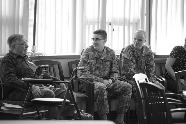
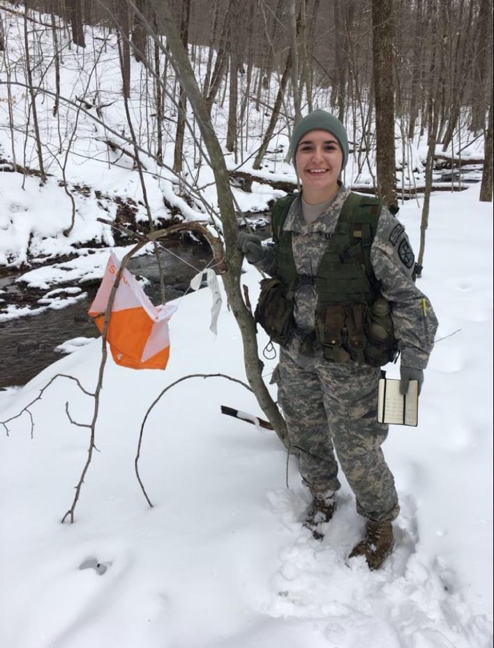
The Seneca Battalion Army ROTC faced a land navigation course at Nine Mile State Park that tested its skills as a part of a super lab training exercise Saturday. Land navigation is used to determine geographical location and reach other specific locations, which is critical for future Army officers to know.
Cadets were given approximately five hours to find six points, marked by orange and white kites hung from trees throughout the park. The grid coordinates of each point were printed on a slip of paper for each team. Teams consisted of approximately three cadets each, as freshmen were paired with sophomores or juniors. More experienced cadets were challenged to face the course on their own.
Using only a compass, map and protractor, each team plotted its given points. To travel between points, cadets determined the distance, in meters, between points, and the azimuth, or direction in which they had to travel to reach the point.
To approximately measure distance, cadets kept their pace by counting the number of steps they took. Cadets simultaneously used their compasses to orient the degree at which they were heading.
Land marks provided on the maps were intended to help with orienteering. Recognizable terrain features such as rivers, trails, ridges and hills could help cadets in determining their locations.
Cadet Jasmine Clasing, a sophomore sociology major, was initially nervous about this exercise because she did not feel confident with her land navigation skills. Working together with her fellow cadets made the task doable. She stressed the importance of learning fundamentals, such as land navigation, as a freshman MSI and sophomore MSII to progress skills for when he or she is an upperclassman.
Clasing also learned how to remain determined in discouraging circumstances while looking for her fifth and final point. After hiking the measured 710 meters to the point, her team still couldn’t find the kite marker. In such situations, teams had to use problem solving skills, including tactics such as following footprints, using landmarks or working with other teams to find the points.
“Land navigation is essentially problem solving and as an officer you will use the skill often,” Clasing said.
Cadet Michael Baker, a sophomore sociology major, said land navigation is a “basic skill any soldier will be able to utilize and need.”
Although soldiers of today can utilize advanced technology, cadets learned that, in many conditions, technology will fail and cannot be relied on. In these situations, it is still important to know their location and how to reach other locations in order to complete a mission.
To learn more about the Seneca Battalion, email recruiting officer Captain Jared Kausner at jkausner@sbu.edu and follow st_bonas_army_rotc on Instagram.
“You can never expect to be the best without giving your full effort because there’s always room to grow,” said Cadet Baker.
andersvh16@bonaventure.edu